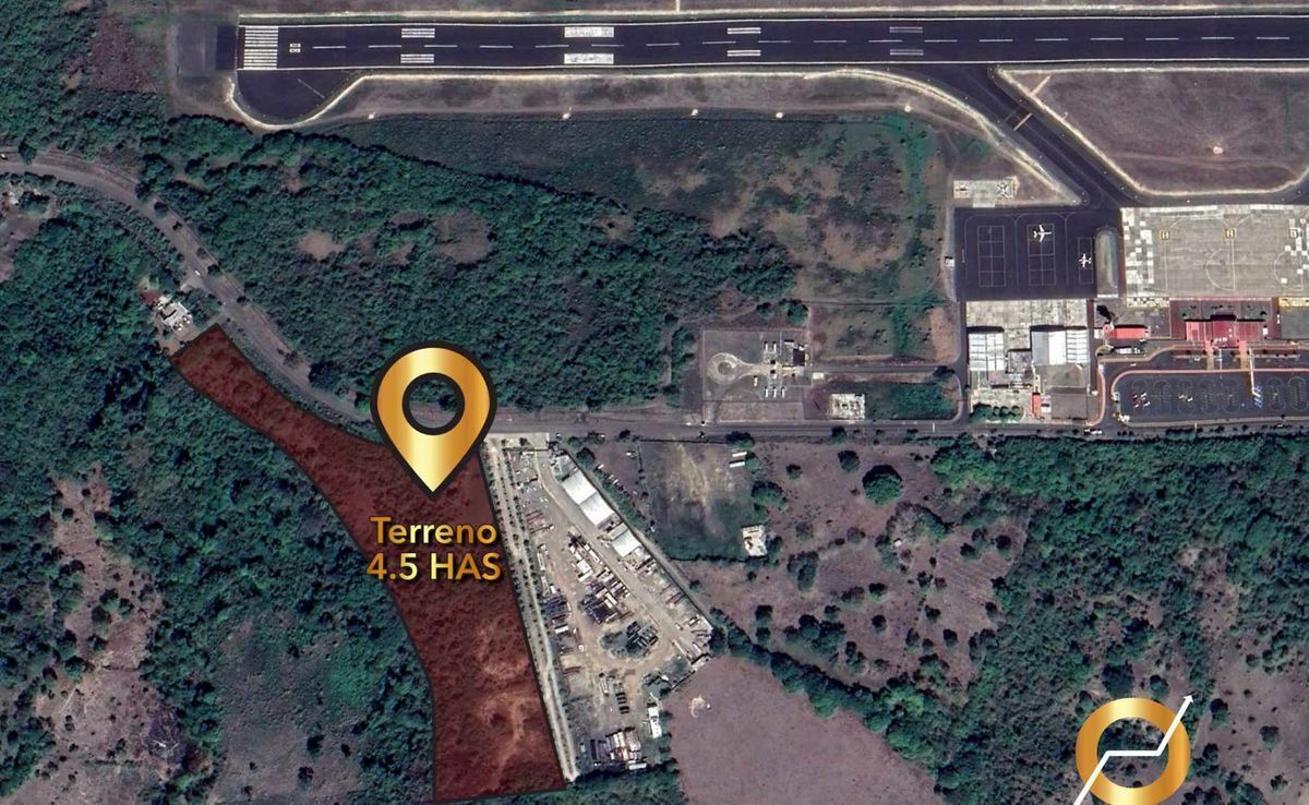
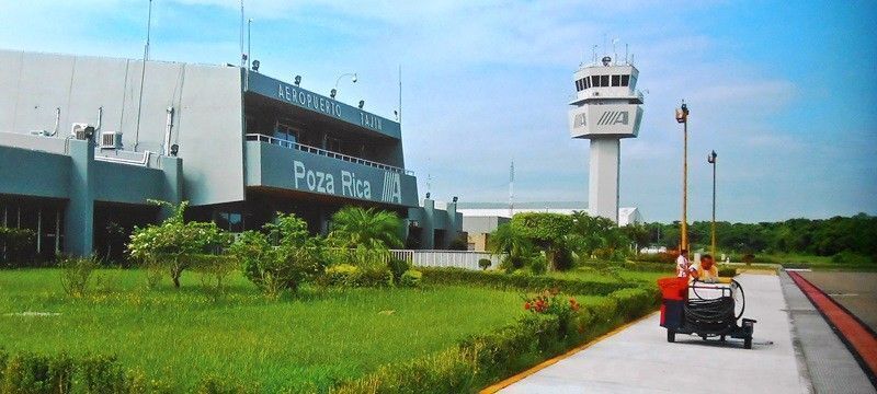
Large plot of 4.5 hectares, sold in whole or in parts. Price announced by has. located in the industrial corridor of Poza Rica, Veracruz; it borders the “El Tajín” International Airport (150 meters away), which implies military surveillance 24 hours a day, and its unique location makes the terrain extremely rich in green areas and all kinds of vegetation typical of the area, located in a mountainous area with a spectacular view of the city of Poza Rica, in addition to all this, the land is also located near the Cazones River, which is a short Mexican river on the slope of the Gulf of Mexico. It originates in the springs of the Sierra Madre Oriental in the state of Hidalgo and crosses the mountainous region of the north of the state of Puebla on its way to the coastal plains of the state of Veracruz, to finally flow into the waters of the Gulf of Mexico. This system provides the drinking water system of the Veracruz city of Poza Rica de Hidalgo.
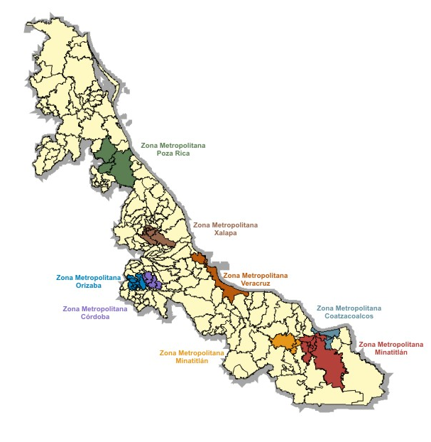
Poza Rica de Hidalgo is a municipality located in the north of the Mexican state of Veracruz, in the east of the Mexican Republic, the main urban center in the northern part of the state. Its conurbated area is made up of settlements and population centers, subdivisions, colonies, industrial and commercial areas, located on the territories of neighboring municipalities in a conurbation in the process of ratification by the municipalities involved and the State Congress, in which the city of Poza Rica would constitute the central nucleus and which would include five municipalities in a partial form, with peripheral sectors of the municipalities of Coatzintla, Tihuatlán and Cazones.
Surrounding areas of the land:
North adjoining: 325m. with Highway to the Airport and crossing said road, airport reservation area.
South adjoining: 120 mts. with Rancho on plot #49, restricted to the passage through its own fence, for the circulation of cars only.
Eastern border: 319 mts. with Av. Palmas (private), 20 mts. wide and with a palm tree street.
West Boundary: 394 with a mountainous precipice, overlooking the city of Poza Rica.
*The published price is a reference and does not constitute a binding offer and can be modified at any time and without prior notice. Likewise, the prices do not include amounts generated by contracting mortgage loans nor do they include expenses, duties and taxes.
*The published price is for cash payment, all the measures listed are indicative, the exact measurements are those expressed in the respective title to each property.
*Photographs, images and videos are illustrative and not contractual.Amplio terreno de 4.5 Hectáreas de extensión, Se vende todo o en partes. Precio anunciado por has. ubicado en el corredor industrial de Poza Rica, Veracruz; colinda con el Aeropuerto Internacional «El Tajín» (a 150 mts.), lo cual implica vigilancia militar las 24 horas del día, asimismo su singular ubicación hace al terreno sumamente rico en áreas verdes y todo tipo de vegetación propia de la zona, localizado en zona montañosa con una vista espectacular de la ciudad de Poza Rica, además de todo esto el terreno también se encuentra cerca del río Cazones el cual es un corto río de México de la vertiente del golfo de México. Se origina en los manantiales de la sierra Madre Oriental en el estado de Hidalgo y atraviesa la región montañosa del norte del estado de Puebla en su recorrido hacia las planicies costeras del estado de Veracruz, para desembocar finalmente en las aguas del golfo de México. Este sistema provee al sistema de agua potable de la ciudad veracruzana de Poza Rica de Hidalgo.
Poza Rica de Hidalgo es un municipio localizado al norte del estado mexicano de Veracruz, al oriente de la República Mexicana, el principal núcleo urbano de la zona norte de la entidad. Su zona conurbada está conformada por asentamientos y núcleos de población, fraccionamientos, colonias, áreas industriales y comerciales, asentadas sobre territorios de los municipios limítrofes en una conurbación en proceso de ratificación por parte de los Ayuntamientos involucrados y el Congreso del Estado, en la que la ciudad de Poza Rica constituiría el núcleo central y que incluiría cinco municipios en forma parcial, con sectores periféricos de los municipios de Coatzintla, Tihuatlán y Cazones.
Colindancias del terreno:
Colindancia Norte: 325m. con Carretera al Aeropuerto y cruzando dicha carretera, área de reserva del aeropuerto.
Colindancia Sur: 120 mts. con Rancho de la parcela #49, restringido el paso por una barda propia, para circulación solo de autos.
Colindancia Este: 319 mts. con Av. Palmas (privada) de 20 mts. de ancho y con camellón de palmeras.
Colindancia Oeste: 394 con precipicio montañoso, con vista a la ciudad de Poza Rica.
*El precio publicado es referencia y no constituye una oferta vinculante y puede ser modificados en cualquier momento y sin previo aviso, así mismo, los precios no incluyen cantidades generadas por contratación de créditos hipotecarios ni tampoco gastos, derechos e impuestos.
*El precio publicado es por pago de contado, todas las medidas enunciadas son orientativas, las medidas exactas son las que se expresan en el respectivo título de propiedad de cada inmueble.
*Fotografías, imágenes y videos son ilustrativos y no contractuales.
 Land for Sale next to Poza Rica National Airport, VeracruzTerreno en Venta a un costado del Aeropuerto Nacional de Poza Rica, Veracruz




 Ver Tour Virtual

